Day 8 Plan – Ambition over Sense

posted in: All Trails, Planning | 0

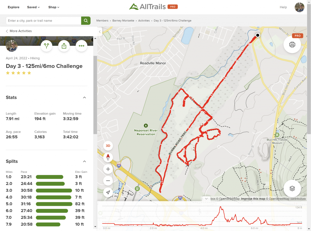
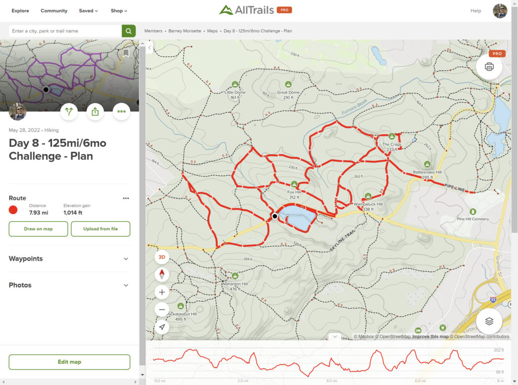
So on Day 3 of this adventure I managed to cover 7.9 miles and that got it in my head that 8 miles is a reasonable goal for each weekend. Then on Day 5, I came to appreciate how much of a factor the elevation change of the hike plays into my endurance. I felt like I damn near had a heart attack that day when I covered 6.5 miles with over 1,000 feet of elevation gain. So you think I’d scale it back a bit and be more sensible and reasonable with my plans. Nope! I’m gonna go ahead and try and do another 8-mile hike with 1,000+ feet of elevation gain. If I can follow this plan, then I’m done with the 4,000’s and can move on to another area in the Blue Hills. Plus, while I say this is a 6-month challenge, I am really hoping wrap it up by the end of August before the kids head back to school. On top of all that, the final rationale for continuing to push, is that a thru-hike of the Appalachian Trail has been on my bucket list since I was a teenager and this whole challenge is a first step on trying to make that dream a reality. Hiking the AT means being able to cover about 15 miles a day while carrying as much as 50 pounds on my back. So shooting for 8 miles with just a 10 pound daypack is a very necessary stepping stone.
AllTrails Map – Day 7

posted in: All Trails, Update | 0

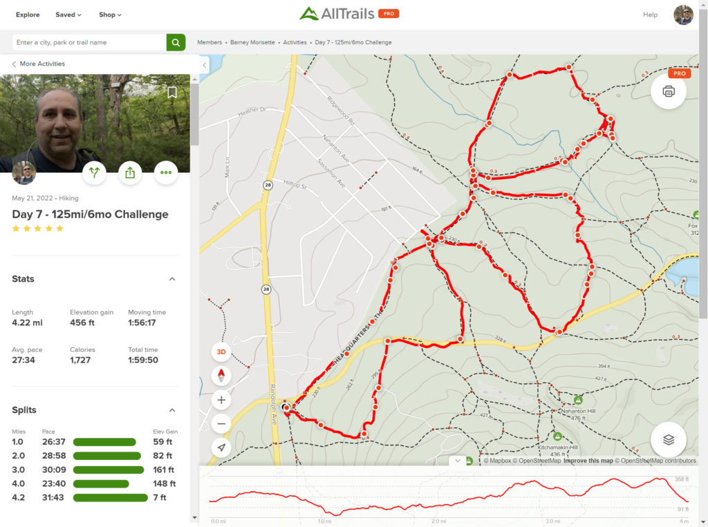
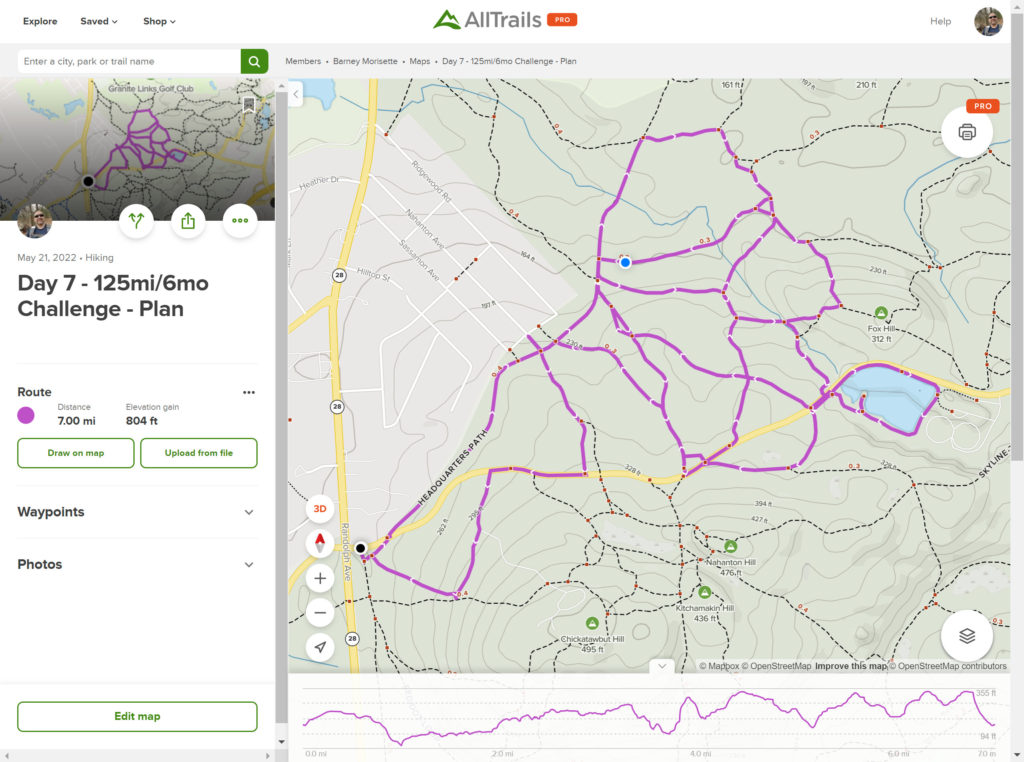
The Day 7 plan was an ambitious 7-miler that would cover almost all of the remaining intersection markers from the 4000’s block. Alas, that plan did not come to fruition. So the 4-miler I got in still leaves a lot of the 4000’s left to cover but hopefully I’ll be able to mark this whole section done next week.

AllTrails Map – Day 6

posted in: All Trails, Update | 0

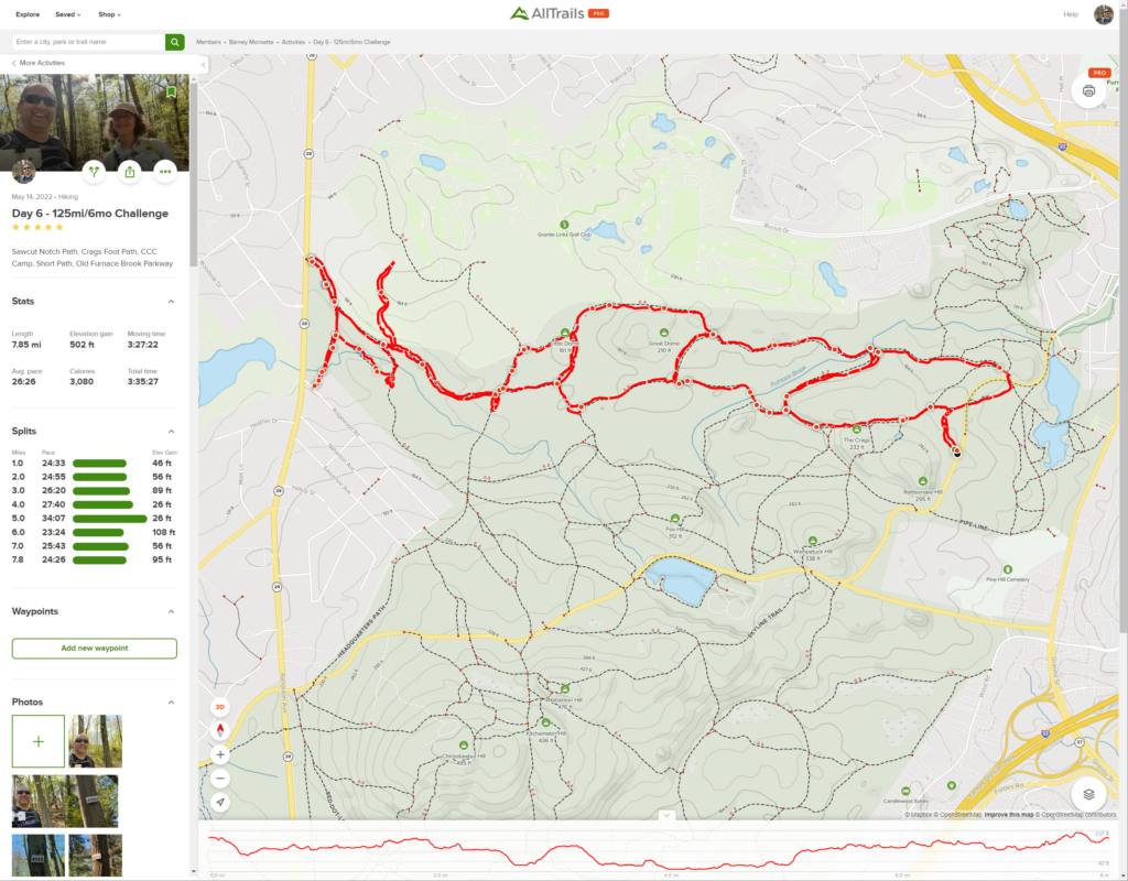
Unlike last week, I was able to pretty much stick to my plan. Covered Sawcut Notch Path, Crags Foot Path, Short Path, and Old Furnace Brook Path. There is one dead-end trail right before the rectangle shape that was on the Blue Hills Reservation map, but no record of it in AllTrails. I was worried this would be some overgrown path that would require hacking through thorn bushes and mud, but in reality it was an easy to find path that was more like a small ravine that wound up to the edge of the 4th Hole of the Milton Course at Granite Links.

Day 6 Plan – Sawcut Notch and Crags Foot Path plus the CCC Camp

posted in: All Trails, Planning | 0

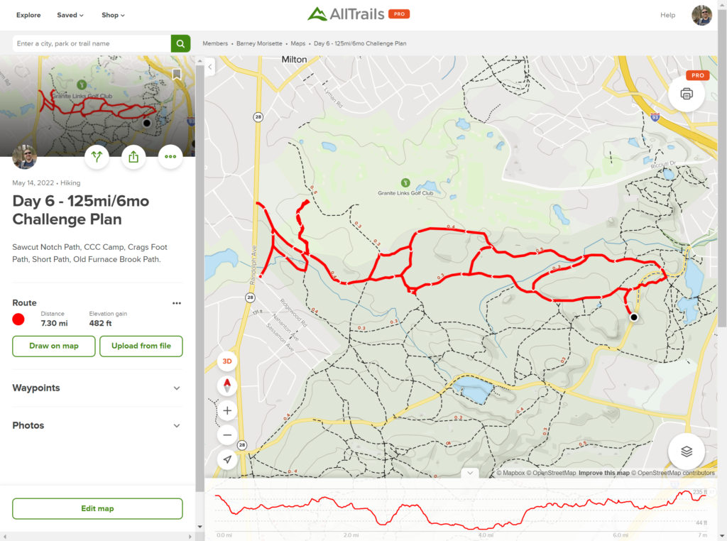
I’m going to keep being ambitious and planning out 7-8 mile hikes otherwise I’ll never finish this challenge by the end of the summer. For Day 6, I’m heading back to the 4000’s. Planning to park at the very small lot off Wampatuck Road and then make a sort of zig-zag loop out of Crags Foot Path and the Sawcut Notch Path, with side runs through the Short Path and Old Furnace Brook Path. Gonna hike that all the way to the CCC Camp and stomp around there for a bit to hit all those dead-end trails, then come back via the opposite zig-zag. Less than half the elevation change from last weeks hike so I shouldn’t be as winded this time, but the temps will be peaking into the 80’s so will bring plenty of water. As always, reach out to me if you want to meetup for this one. Planning on and early morning start to avoid hiking through the hottest part of the day.

AllTrails Map – Day 5

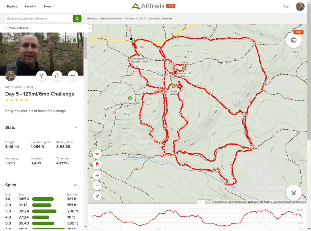
Two things to note about this map. One – ELEVATION!!! 1,056 Feet (322 Meters)! That’s the same height as the Chrysler Building, including the antenna, and an extra 10 feet thrown in for good measure. Two – I totally screwed up my well thought out plan by taking the wrong trail from the very beginning and then towards the end I really went off track, literally. I was curious about the fire damage, so I went off trail and followed the edge of the burn zone to get a sense of how much area it covered.

Day 5 Plan – May 2022 Brush Fire – Damage Check

posted in: All Trails, Planning | 0

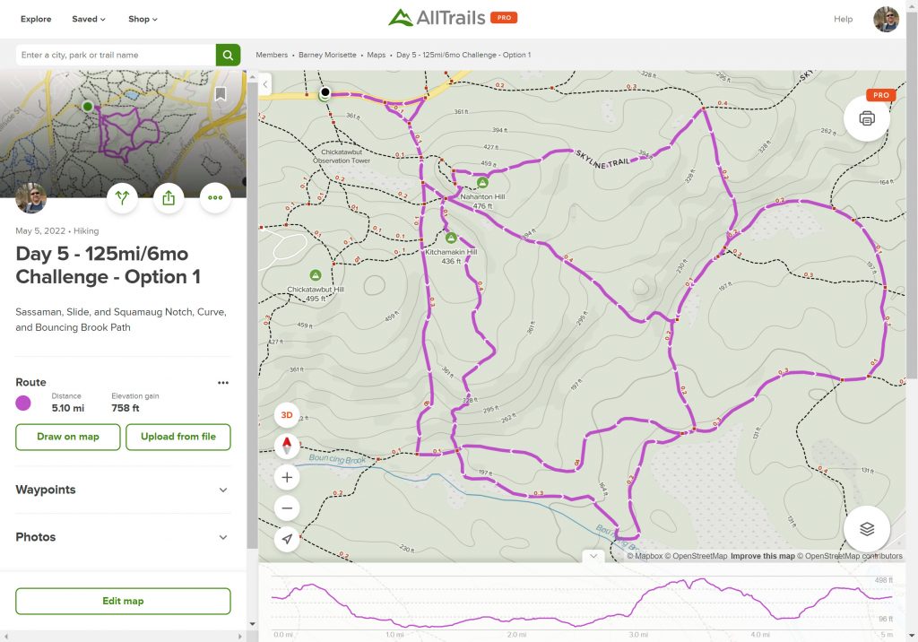
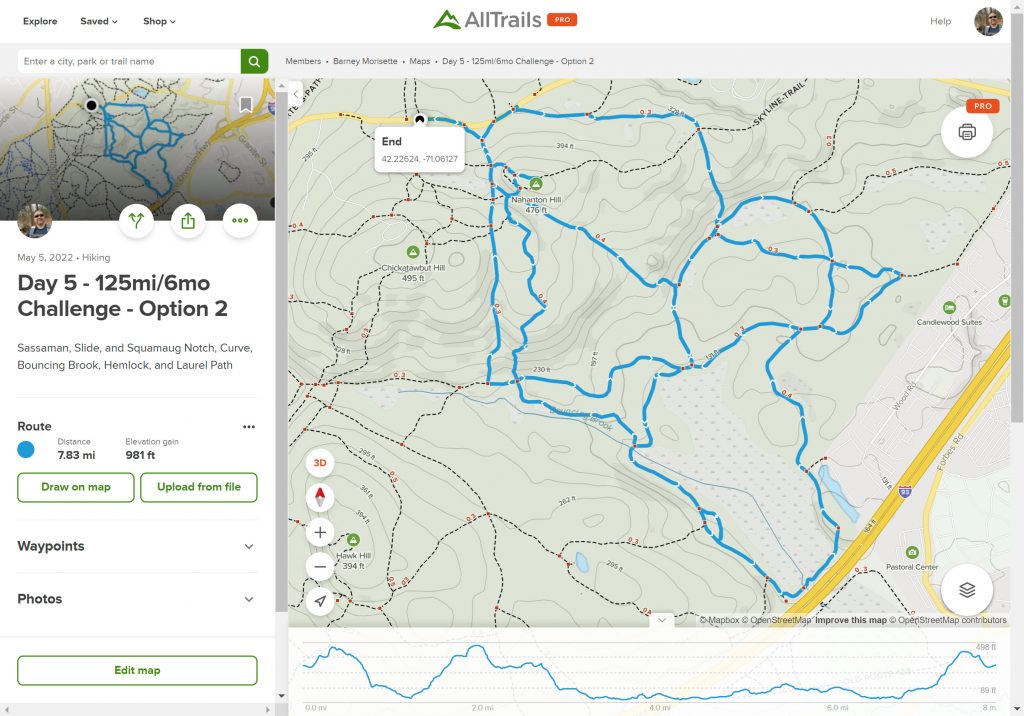
As soon as I finished my hike last Saturday I was already thinking ahead to next week. My plan on Saturday was to keep working on the 4000’s around the Furnace Brook area to build off my Day 3 hike around St. Moritz Pond. Then on Sunday I heard about the brush fire in the Blue Hills. It took a few days to figure out the rough area of the fire but when the news stations showed the aerial shots I noticed the array of solar panels near the fire trucks. With that in mind I checked out Google Earth and found that the solar panels were the ones near the Norman Smith EEC. With that reference point, it appeared that the fire was in the area between the Slide Notch and Sassamon Notch Paths. Yesterday my sleuthing was confirmed when the Friends of the Blue Hill shared a post identifying Saturday’s fire as the Slide Notch fire. Obviously, curiosity has gotten the better of me so this week’s plan is to hike the trails around the area of the brush fire to see how extensive the damage is. I have two plans worked up, one a 5 mile hike, the other one just shy of 8 miles. I’m pushing for the longer one, but my family may rebel and insist on the 5-miler or refuse to come. The results of this stand-off will be determined by Saturday morn.

This is the shorter of the two planned hikes. Just over 5 miles but with a good amount of elevation change.
This hike adds about 2.6 miles to the hike above, but most of that is flat so it shouldn’t be that much harder.

AllTrails Map – Day 4

posted in: All Trails, Update | 0

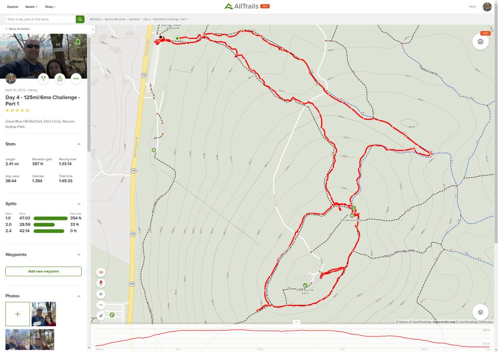
I really regret not taking the quick side trip to complete the inner track of Eliot Loop. I’ll have to remember to include that when I cap the Challenge off with the Skyline Trail.

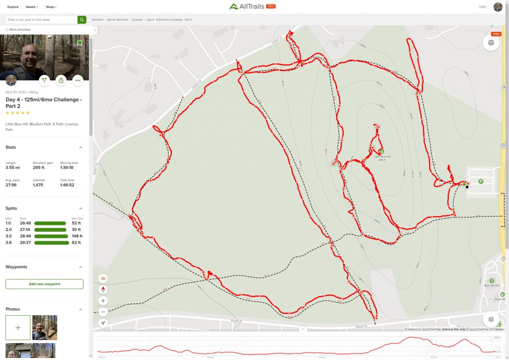
Part 2 of the hike – I am definitely making better time when I’m on my own.

Day 4 Plan – Great Blue Hill and Little Blue Hill

posted in: All Trails, Planning | 0

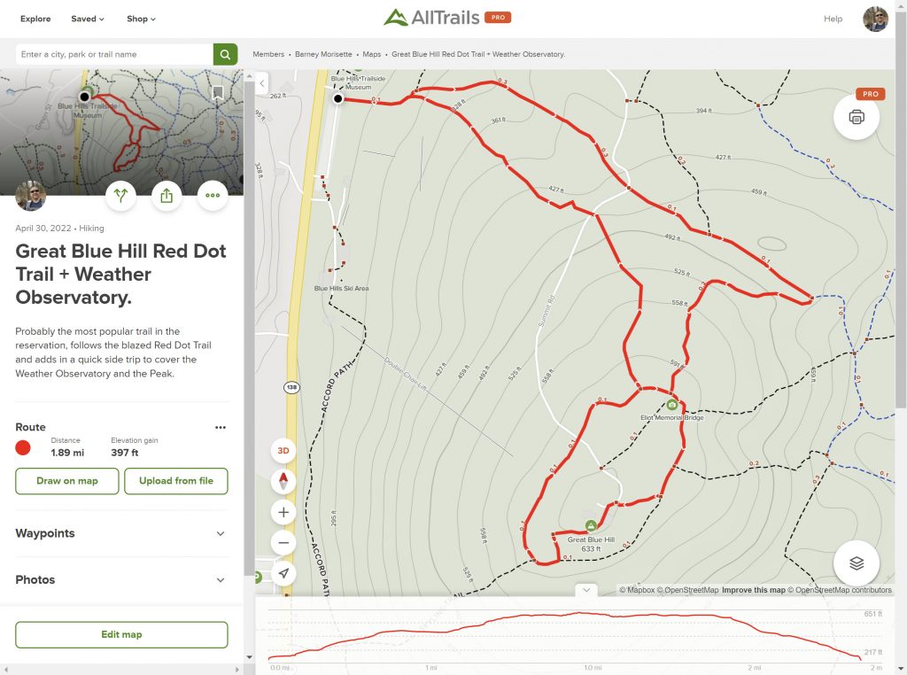
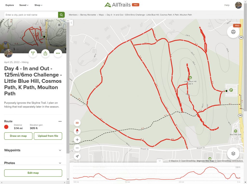
Patricia is gathering her Au Pair group for a hike up the popular red-dot trail to the summit of Great Blue Hill on Saturday. She’s an LCC for Cultural Care Au Pair so she organizes monthly activities for the group of Au Pairs that she looks after. (If anyone is curious about the Au Pair program, let me know and Patricia can tell you all about it). I’m going to join them for the hike and then after they are done, I’m going to keep going and hike the trails around Little Blue Hill on the other side of Washington Street. Patricia and Penny may or may not join me for this part. We shall see. I split the planned hike into two parts in All Trails accordingly.

https://www.alltrails.com/explore/map/day-4-loop-little-blue-hill-cosmos-path-k-path-moulton-path-c7a9f13?u=i