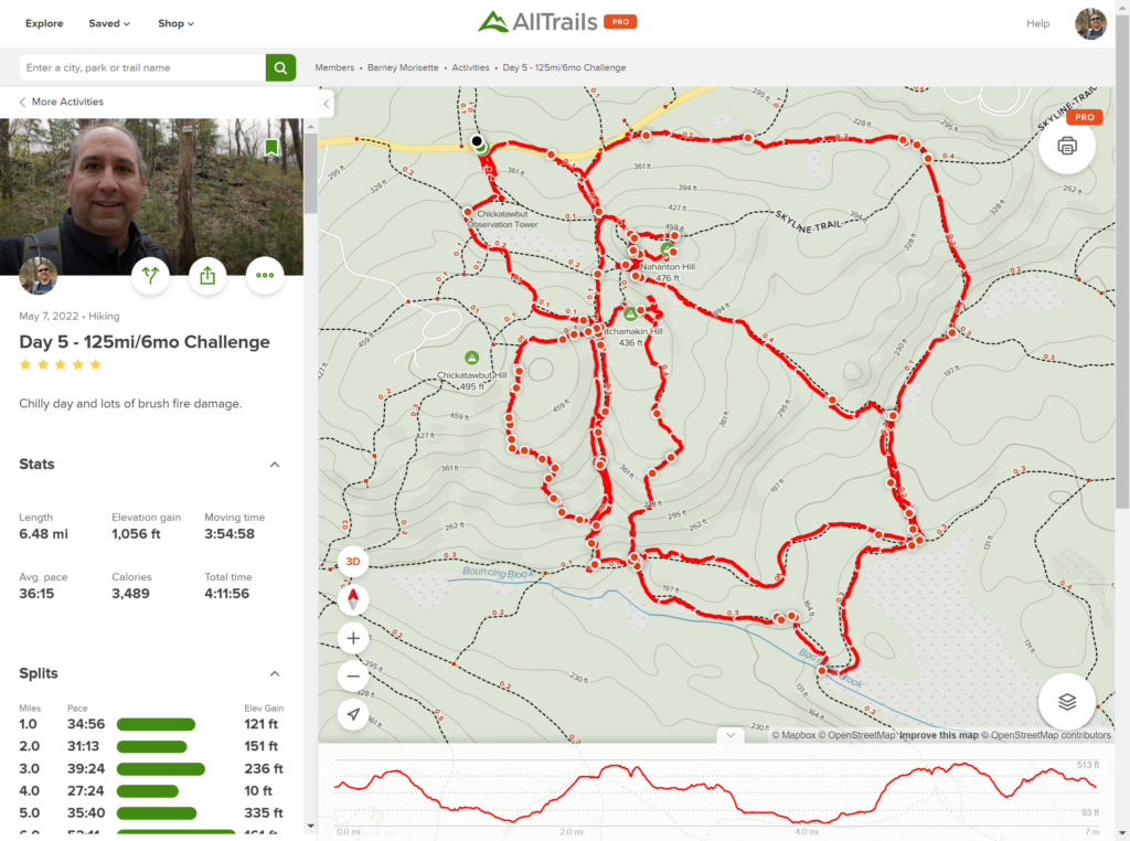
Two things to note about this map. One – ELEVATION!!! 1,056 Feet (322 Meters)! That’s the same height as the Chrysler Building, including the antenna, and an extra 10 feet thrown in for good measure. Two – I totally screwed up my well thought out plan by taking the wrong trail from the very beginning and then towards the end I really went off track, literally. I was curious about the fire damage, so I went off trail and followed the edge of the burn zone to get a sense of how much area it covered.


Leave a Reply